Maryport and Hadrian’s Wall
") Hadrian's Wall at Castle Nick (courtesy Roger Clegg and the Hadrian's Wall Trust)In Britain, Hadrian’s Wall was built in the 120s and continued in occupation until about 410, apart from the 20 years from about 142 when it was superseded by the Antonine Wall to the north.
Hadrian's Wall at Castle Nick (courtesy Roger Clegg and the Hadrian's Wall Trust)In Britain, Hadrian’s Wall was built in the 120s and continued in occupation until about 410, apart from the 20 years from about 142 when it was superseded by the Antonine Wall to the north.
It consisted of a barrier of stone or turf fronted by a wide and deep ditch running across northern England from the River Tyne to the Solway Estuary. Gates, known as milecastles, were placed at intervals of one mile (1.6 km), with two towers in between. During the building process, forts were moved from further south and built on the Wall line while a great earthwork known as the Vallum – a sort of Roman barbed-wire installation – was thrown up behind the Wall.
Although the Wall ended at Bowness-on-Solway, the system of forts, fortlets and towers was continued down the Cumbrian coast in the west for about 25 miles (40 km). One of these forts lay at Maryport.
Maryport was the base of an auxiliary regiment: several are attested here at different times. The site has produced an important and fascinating collection of inscriptions and sculpture. Of particular importance is the series of dedications by the commanding officers of the First Cohort of Spaniards which demonstrates that the average length of service of the commanding officer of such a unit was 3 years. The origins and careers of these officers provide links between Maryport and many provinces of the empire in Europe and beyond, emphasising the cosmopolitan nature of the Roman empire.
Map of Hadrian`s Wall
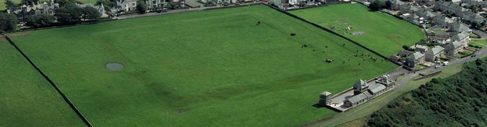
Senhouse Roman Museum
Maryport is fortunate in having not only the remains of an important Roman fort, but also the largest group of Roman military altar stones and inscriptions from any site in Britain and unique examples of Romano-British religious sculpture.
The collection, which was begun by the Senhouse family in the 1570s, is the oldest in the country, and is of international importance. It is housed, along with various other artefacts from the fort, in the Senhouse Roman Museum which lies immediately adjacent to the site of the fort.
 Maryport, Magnetometry SurveyGeophysical surveys in the fields to the north of the Fort, have revealed that the Roman civilian settlement was far larger than had hitherto been supposed. The Maryport site is therefore very comparable to Ruffenhofen on the Raetian Limes, where extensive magnetometry and resistivity surveys over ca. 70 acres revealed a complete picture of the fort and its civilian settlement.